
Category:Aviation maps of Europe
Media in category "Aviation maps of Europe"
The following 20 files are in this category, out of 20 total.
-
 100329 Zielgebietskarte S2010.png 2,335 × 1,208; 216 KB
-
 Alitalia European Network at S13.png 720 × 360; 114 KB
-
.It_includes_all_destinations_(Charter%2C_Cargo%2C_Terminated%2C_All_Year).png/120px-ATH_Destination_Map_(New_2016).It_includes_all_destinations_(Charter%2C_Cargo%2C_Terminated%2C_All_Year).png)
-

-
 Cargo flights.png 1,000 × 855; 248 KB
-
 CLJroutes.png 1,075 × 760; 63 KB
-
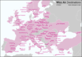
 EAN Standorte EU.png 1,270 × 1,161; 47 KB
-
.jpg/120px-Europe%27s_20_Busiest_Airports_(2023).jpg) Europe's 20 Busiest Airports (2023).jpg 3,136 × 2,423; 541 KB
Europe's 20 Busiest Airports (2023).jpg 3,136 × 2,423; 541 KB
-
 Europe's Busiest Airports.png 3,134 × 2,424; 1.06 MB
-
 Europe's Twenty Busiest Airports, 2023.gif 753 × 582; 110 KB
-
 Fleet EATC.png 3,371 × 2,280; 1.63 MB
-
 Network Genoa Airport.png 1,508 × 1,275; 2.21 MB
-
 PaísesALC.png 1,257 × 1,011; 214 KB
-
 Skyalps S 2024.pptx.png 682 × 717; 85 KB
-
 Skyalps W 2324.png 578 × 727; 402 KB
-
 Transavia France Destination.jpg 2,200 × 1,149; 833 KB
-
 Transport A380 TR.jpg 785 × 915; 120 KB
-
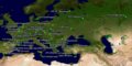
 Travel crisis in Europe 2010.png 1,200 × 1,000; 42 KB
-
 Wizz Air Destinations 2012.png 1,028 × 711; 365 KB
-
 Wizzair-ის მიმართულებები.jpg 1,364 × 1,084; 301 KB


.It_includes_all_destinations_(Charter,_Cargo,_Terminated,_All_Year).png)


.jpg)


